AI and You: Florida’s Digital Twin creates virtual world to view climate change simulations
Florida lies in the middle of a troubling Venn diagram: a swelling population, aging infrastructure and a changing climate. State officials are critically focused on ways to fortify their cities from the dangers of climate change. To help them, UF researchers are developing a toolbox that can visualize potential futures and guide city leaders to make informed decisions for their citizens’ health, safety and economic security.
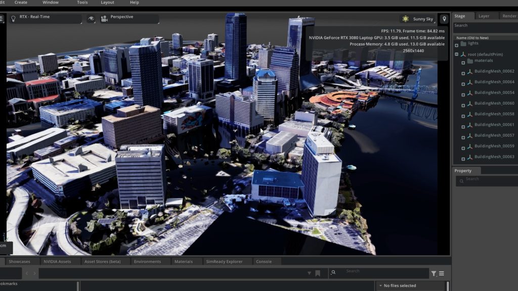
In January, more than 40 students, staff and faculty across five UF colleges started developing Florida’s Digital Twin, beginning with the city of Jacksonville. Christine Angelini, director of the UF Center for Coastal Solutions, is one of the leads of the JaxTwin project, which is creating a virtual model of the city that can be manipulated to show how ideas and plans respond to lifelike scenarios. This work started in Jacksonville because of the university’s deep roots in the First Coast — UF Health Jacksonville offers unique health data on the region, and the university is exploring the creation of an urban campus in the heart of the city’s downtown district.
“How do we sustain the quality of life in the state of Florida?” Angelini said. “It’s to build a collaboration platform to connect UF experts, and the rich datasets they work with, to one another and to decision makers in Florida striving to make proactive investments for their communities.”
The project is supported by $1.75 million in strategic funding from the Florida Legislature that will allow units at UF to work more effectively with local and state partners, including Jacksonville Mayor Donna Deegan.
The immersive 3D model will create not only the physical environment, including buildings, roads, and critical infrastructure, but also the natural environment like waterways, human health information and socio-economic indicators, Angelini said. HiPerGator is handling the heavy lifting to make this viewable through an augmented reality headset since it is managing huge data sets, running big models and generating a visualization environment to support the simulation. Beyond the hardware, NVIDIA’s software Omniverse provides the building blocks for the simulations.
Jeff Carney, an associate professor in UF’s School of Architecture and the director of the Florida Institute for Built Environment Resilience Fiber, is another lead on the project with Angelini. While the project is still in its infancy stage, in its full articulation, it would allow for near real simulations of future scenarios, he said.

“The tool is a way to visualize and demonstrate through scenarios different combinations of social and built environment factors, so things like health, housing and environmental systems, and how they’re impacted by flood risk,” he said. “It empowers the user to actually test those things.”
Florida Digital Twin connects the various obligations and values of the cross-discipline researchers. For someone in architecture and urban planning, Carney said his professional obligation is to help someone build a safer building, but this project allows those across fields to work together to challenge assumptions and view multiple types of data concurrently.
“It forces all of us to leave our comfort zone,” Carney said.
Angelini said her goal is to build a solution simulation system that could create countless different potential solutions to address water quality issues that are easily viewed and understood.
Ultimately, JaxTwin will help researchers and urban planners answer the tough questions facing our communities. What is the relationship between flooding events and water quality? How are those water quality effects generating cascading impacts on the health of Floridians?
Integrating water data systems with water quality and human health can help stakeholders see the connectivity between these issues and how those interactions change alongside the climate, Angelini said. “How do you integrate these really big, complex data sets together into something meaningful, and then how do you visualize those, those kind of interconnected data systems in a way that activates on the ground action?” Angelini said. “The three-dimensional visualizations that we’re creating in the digital twin bring that data to life and make it really interactive.”
